


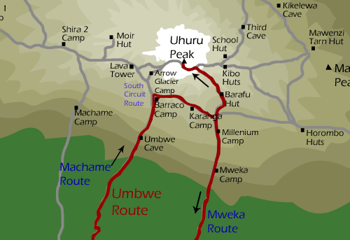
Umbwe Route
6 DAYS, 5 NIGHTS UMBWE ROUTE
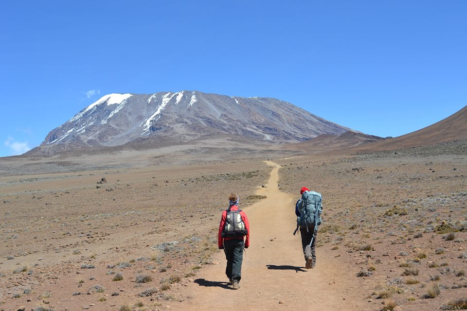
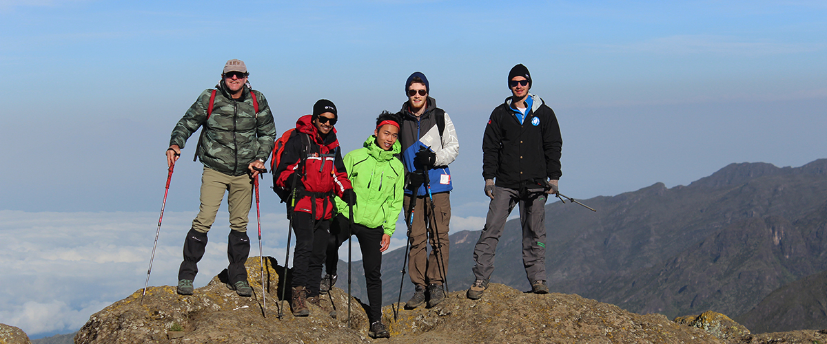
Umbwe Route ** The Umbwe route is a short, steep and direct route. It is considered to be very difficult and is the most challenging way up Mount Kilimanjaro. Due to the quick ascent, Umbwe does not provide the necessary stages for altitude acclimatization. Although the traffic on this route is very low, the chances of success are also low. The route is offered at a minimum of six days, though seven days is recommended when attempting this route. The Umbwe route should only be attempted by those who are very strong hikers and are confident in their ability to acclimatize. However, overall, the Umbwe route is not recommended and we discourage its usage for our clients.
Day 0: Arrive Kilimanjaro International Airport, where you will meet by a Gazelle Adventures representative and transferred to your hotel in Moshi. Evening briefing at hotel to prepare you for the climb ahead, followed by group dinner, an opportunity for the group to get to know each other before the climb.
- No hut required.
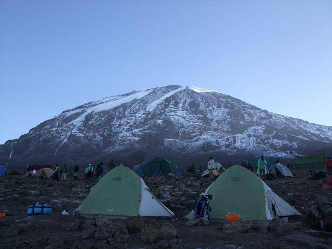
- Camping accommodation available at all camps.
Day –1:
- Umbwe Gate to Umbwe Camp
- Elevation (ft): 5,249 ft to 9,514 ft
- Distance: 11 km
- Hiking Time: 5-7 hours
- Habitat: Rain Forest
After breakfast the day starts at dawn with a 01h45 minutes drive from Moshi to Umbwe gate on arrival at the Parks gate you’re met by your guides and porters. Now Commence on a 4- 5 hour walk through the spectaculars forest to the first camp, Bivouac No.1 (2900m) with access to water. The path begins at (2100m) and generally keeps to the narrow ridge crest between the Lonzo River on the west and the Umbwe on the east. The path gains altitude quickly, and offers some spectacular views of deep gorges. Dinner and overnight at Umbwe forest cave (2,940m)..
Day -2:
- Umbwe Camp to Barranco Camp
- Elevation (ft): 9,514 ft to 13,044 ft
- Distance: 6 km
- Hiking Time: 4-5 hours
- Habitat: Heath
After breakfast walk to Bivouac No. 2 (3780m) just under the first head on view of the peak. If you are feeling strong, then you may continue to Barranco Hut (3976m). The path is fairly steep through the forest, heading along a sharp ridge, before it flattens as you approach Barranco Hut in the more land zone. Dinner and overnight at Barranco camp.
Day –3:
- Barranco Camp to Karanga Camp
- Elevation (ft): 13,044 ft to 13,106 ft
- Distance: 5 km
- Hiking Time: 4-5 hours
- Habitat: Alpine Desert
The morning starts with scramble up the Barranco wall to an altitude of (4200m) and crosses through the south western slopes to reach the Karranga valley after 3 hours, before reaching the camp at Karanga valley below (4033m.) the path offers great views of helm glacier, Kersten and Decken glaciers that forms part of the southern ice fields. Dinner and overnight at Karanga Camp.
Day-4:
- Karanga Camp to Barafu Camp
- Elevation (ft): 13,106 ft to 15,331 ft
- Distance: 4 km
- Hiking Time: 4-5 hours
- Habitat: Alpine Desert
This is the last water stop on the route; there is no water at all at Barafu hut (4673m) so you should take care and stock up your water supply. After breakfast you continue in south-easterly direction to the junction before turning north to reach Barafu hut after about hours. On a clear day the Saddle and Mawenzi can be seen to the east.
Day- 5:
- Barafu Camp to Uhuru Point to Mweka Hut
- Elevation (ft): 15,331 ft to 19,341 ft to 10,065 ft
- Distance: 17 km
- Hiking Time: 11-14 hours
- Habitat: Arctic
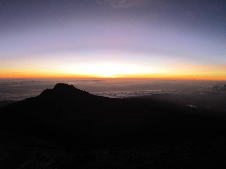
At around midnight you will head in a north-westerly direction up the south East valley toward Stella point on the crater rim. The night is very cold with the footpath rocky and steep in places. The six hour long walk to Stella point is a mental and physical challenge with a steep face just below Stella posing the ultimate challenge .Depending on weather conditions you could encounter snow and ice from below Stella point all the way to Uhuru for about one and offers views of Rebmann, Decken, Kersten and Heim Glaciers. From Uhuru peak you can also see Furtwangler glacier to the north and the Eastern Ice Fields to the northeast the time you spend on the summit is determined by weather and wind conditions, these could cause temperatures to plummet well below minus 30 degree Celsius. The walk back to Barafu Hut from the summit for short rest and collect the rest of your gear heading down to Mweka hut your final camp on the mountain can take over three hours. Dinner and overnight at Mweka Camp.
Day – 6:
- Mweka Camp to Moshi
- Elevation (ft): 10,065 ft to 5,380 ft
- Distance: 10 km
- Hiking Time: 3-4 hours
- Habitat: Rain Forest
Early breakfast and depart for the three hour decent to the parks gate, there is a strong chance of the footpath through the forest being wet, muddy and slippery, but after constantly slipping and sliding you eventually arrive at the Parks gate where your particulars are entered in the register. The guides are issued with green certificates for climbers who reached Stella point and gold certificates for those who reached uhuru peak.
After all formalities are over, continue your descent to Mweka Gate where transport awaits to transfer you to the Hotel in Moshi where certificates are presented during dinner. The drive takes about 1hour.
End of the trek.