


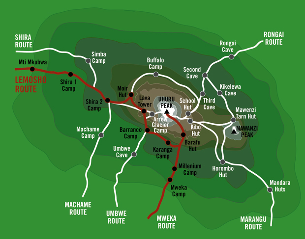
Lemosho Route
8 DAYS, 7 NIGHTS. LEMOSHO
Lemosho Route **** (RECOMMENDED) The Lemosho route is one of the newer routes on Mount Kilimanjaro. The route begins in the west and rather than simply intersecting Shira Plateau (like Machame), Lemosho crosses it from Shira Ridge to Shira Camp. Climbers encounter low traffic until the route joins the Machame route. Afterwards, Lemosho follows the same route through Lava Tower, Barranco and Barafu, known as the southern circuit. The minimum number of days required for this route is six days, although eight days is ideal. Lemosho is considered the most beautiful route on Kilimanjaro and grants panoramic vistas on various sides of the mountain. It is our favorite route because it offers a great balance of low traffic, scenic views and a high summit success rate. Thus, Lemosho comes highly recommended. Most of our clients use Lemosho.
Day 0: Arrive at Kilimanjaro International Airport, where you will be met by a Gazelle Adventures representative and transferred to your hotel in Moshi. A briefing will be conducted in the evening at the hotel to prepare you for the climb ahead, followed by group dinner, an opportunity for the group to get to know each other before the climb. .
- Eight- days option offers an extra day for acclimatization (highly recommended).
- Seven-days option available
- No hut required.
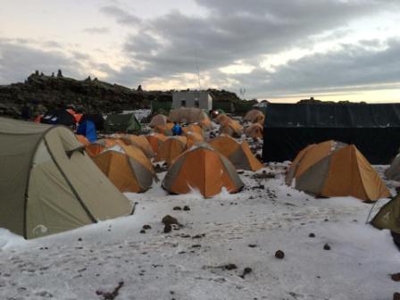
- Camping accommodation available at all camps.
Day 1
- Lemosho Glades to Mti Mkubwa (Big Tree) Camp
- Elevation (ft): 6,825ft to 9,100ft
- Distance: 7 km
- Hiking Time:3-4 hours
- Habitat: Rain Forest
We depart Moshi for Londorossi Gate, which takes about 4 hours, where you will complete entry formalities. Then drive to the Lemosho trailhead (another hour to reach the trailhead). Upon arrival at trailhead, we eat lunch, then commence through undisturbed forest which winds to the first camp site.
DAY 2
- Mti Mkubwa to Shira Camp 1
- Elevation (ft): 9,100ft to 11,500ft
- Distance: 8 km
- Hiking Time 5-6 hours
- Habitat: Moorland
We continue on the trail leading out of the forest and into a savannah of tall grasses, heather, and volcanic rock draped with lichen beards. As we ascend through the lush rolling hills and cross several streams, we reach the Shira Ridge before dropping gently down to Shira 1 camp. The view of Kibo from across the plateau is amazing.
DAY 3
- Shira Camp 1 to Shira 2 to Moir Hut
- Elevation (ft): 11,500ft to 13,800 ft
- Distance: 14 km
- Hiking Time: 5-7 hours
- Habitat: Moorland
We explore the Shira plateau for a full day. It is a gentle walk east toward Kibo’s glaciered peak, across the plateau which leads to Shira 2 camp on moorland meadows by a stream. Then we continue to Moir Hut, a little used site on the base of Lent Hills. A variety of walks are available on Lent Hills making this an excellent acclimatization opportunity. Shira is one of the highest plateaus on earth.
DAY 4
- Moir Hut to Lava Tower to Barranco Camp
- Elevation (ft): 13,800ft to 13,000ft
- Distance: 7 km
- Hiking Time: 4-6 hours
- Habitat: Semi Desert
From the Shira Plateau, we continue to the east up a ridge, passing the junction towards the peak of Kibo. As we continue, our direction changes to the South East towards the Lava Tower, called the "Shark's Tooth." Shortly after the tower, we come to the second junction which brings us up to the Arrow Glacier at an altitude of 16,000ft. We now continue down to the Barranco Hut at an altitude of 13,000ft. Here we rest, enjoy dinner, and overnight. Although you end the day at the same elevation as when you started, this day is very important for acclimatization and will help your body prepare for summit day.
DAY 5
- Barranco Camp to Karanga Camp
- Elevation (ft): 13,000ft to 13,100ft
- Distance: 5km
- Hiking Time: 4-5 hours
- Habitat: Alpine Desert
After breakfast, we leave Barranco and continue on a steep ridge passing the Barranco Wall, to the Karanga Valley campsite. This is a short day meant for acclimatization.
DAY 6
- Karanga Camp to Barafu Camp
- Elevation (ft): 13,100ft to 15,300ft
- Distance: 4 km
- Hiking Time: 4-5 hours
- Habitat: Alpine Desert
After breakfast, we leave Karanga and hit the junction which connects with the Mweka Trail. We continue up to the Barafu Hut. At this point, you have completed the South Circuit, which offers views of the summit from many different angles. Here we make camp, rest, enjoy dinner, and prepare for the summit day. The two peaks of Mawenzi and Kibo are to be seen from this position.
DAY 7
- Barafu Camp to Summit to Mweka Hut
- Elevation (ft): 15,300ft to 19,345ft (and down to 10,000ft)
- Distance: 5 km ascent / 12 km descent
- Hiking Time: 7-8 hours ascent / 4-6 hours descent
- Habitat: Arctic
Very early in the morning (midnight to 2am), we continue our way to the summit between the Rebmann and Ratzel glaciers. You head in a northwesterly direction and ascend through heavy scree towards Stella Point on the crater rim. This is the most mentally and physically challenging portion of the trek.
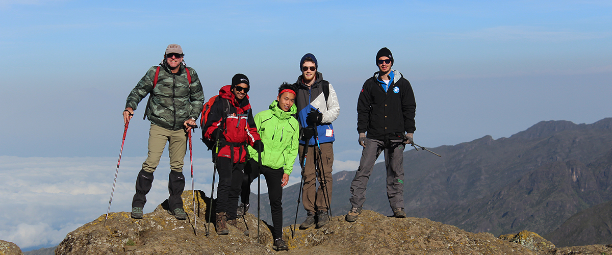
At Stella Point (18,600 ft), you will stop for a short rest and will be rewarded with the most magnificent sunrise you are ever likely to see (weather permitting). From Stella Point, you may encounter snow all they way on your 1-hour ascent to the summit. At Uhuru Peak, you have reached the highest point on Mount Kilimanjaro and the continent of Africa. Faster hikers will see the sunrise from the summit.
From the summit, we now make our descent continuing straight down to the Mweka Hut camp site, stopping at Barafu for lunch. You will want gaiters and trekking poles for the loose gravel going down. Mweka Camp is situated in the upper forest and mist or rain can be expected in the late afternoon. Later in the evening, we enjoy our last dinner on the mountain and a well-earned sleep.
DAY 8
- Mweka Camp to Moshi
- Elevation (ft): 10,000ft to 5,400ft
- Distance: 10 km
- Hiking Time: 3-4 hours
- Habitat: Rain Forest
After breakfast, we continue the descent down to the Mweka Park Gate to receive your summit certificates. At lower elevations, it can be wet and muddy. Gaiters and trekking poles will help. Shorts and t-shirts will probably be plenty to wear (keep rain gear and warmer clothing handy).
From the gate, you continue another hour to Mweka Village. A vehicle will meet you at Mweka village to drive you back to hotel in Moshi.
END OF TREK