


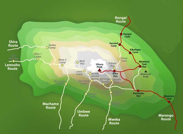
Rongai Route
7 DAYS, 6 NIGHT'S RONGAI ROUTE
Rongai Route *** (GOOD) The Rongai route is the only route that approaches Kilimanjaro from the north, close to the Kenyan border. Though gaining popularity amongst climbers, Rongai has low traffic. It is the preferred route for those looking for an alternative to the crowded Marangu route, for those who would like a more remote hike, and for those who are climbing during the rainy season (the north side receives less precipitation). The minimum number of days required for this route is six days, and seven days are recommended. Although the scenery is not as varied as the western routes, Rongai makes up for this by passing through true wilderness areas for days before joining the Marangu route at Kibo camp. This route descends down the Marangu route. Rongai is a moderately difficult route, and is highly recommended, especially for those with less backpacking experience.
Day 0: Arrive Kilimanjaro International Airport, where you will be met by a Gazelle Adventures representative and transferred to your hotel in Moshi. Evening briefing at hotel to prepare you for the climb ahead, followed by group dinner, an opportunity for the group to get to know each other before the climb.
- Seven- day option offers an extra day for acclimatization (highly recommended).
- Six-day option available
- No hut required.
- Camping accommodation available at all camps.
DAY 1:
- Rongai Gate to Rongai Cave
- Elevation (ft): 6,398 ft to 9,300 ft
- Distance: 7 km
- Hiking Time: 3-4 hours
- Habitat: Rain Forest
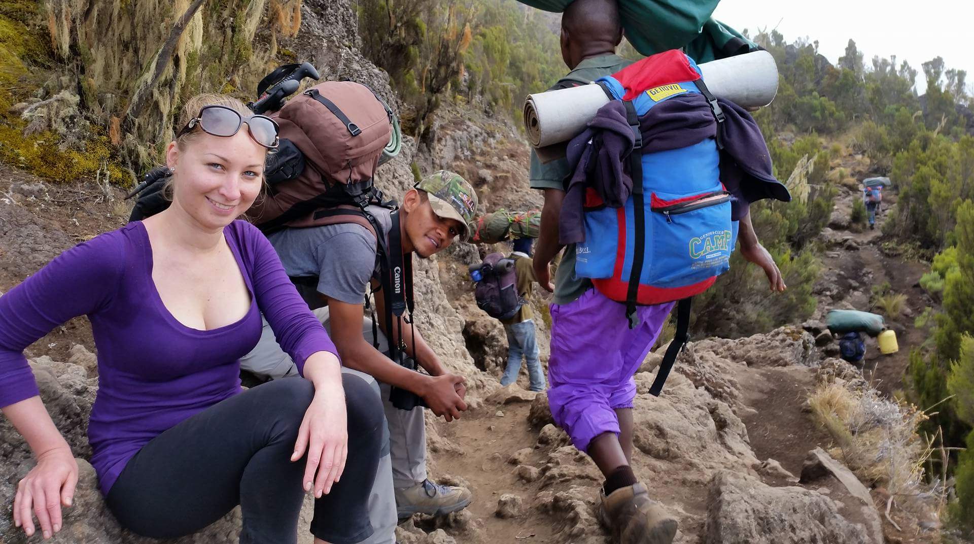
We take a ride to Marangu to complete the necessary registration formalities, before to Rongai. The climb begins from Nale Moru (6,400 ft) on a small path that winds through fields of maize and potatoes before entering a pine forest. The track then starts to climb consistently, but gently through an attractive forest that shelters a variety of wildlife, including the Colobus monkey. These monkeys are black with a long ‘cape’ of white hair and a flowing white tail. The forest begins to thin out at the edge of the moorland zone. Then, we take in the expansive views over the Kenyan plains as we arrive at our first campsite at Rongai One (8,500 ft), dinner and overnight. [3-4 hours walking]
DAY 2:
- Rongai Cave to 2nd Cave to Kikelewa Cave
- Elevation (ft): 9,300 ft to 11,811 ft
- Distance: 12 km
- Hiking Time: 6-8 hours
- Habitat: Health
The morning walk is a steady ascent up to the Second Cave (11,300 ft) with superb views of Kibo and the Eastern Icefields on the crater rim. After lunch, we leave the main trail and strike out and head southeast across the moorland on a smaller path towards the jagged peaks of Mawenzi. Our campsite is in a sheltered valley, decorated with giant senesces near Kikelewa Caves (11,800 ft). [6-7 hours walking]. Dinner and overnight at Rongai two Camp.
DAY 3:
- Kikelewa Cave to Mawenzi Tarn
- Elevation (ft): 11,811 ft to 14,160 ft
- Distance: 5 km
- Hiking Time: 3-4 hours
- Habitat: Alpine Desert
A short but steep climb is rewarded by superb all-around views and a tangible sense of wilderness. We leave vegetation behind shortly before reaching the next camp at Mawenzi Tarn hut (14,200 ft), spectacularly situated in a cirque directly beneath the towering spires of Mawenzi. The afternoon will be free to rest or explore the surrounding area as an aid to acclimatization. [3-4 hours walking] . Dinner and overnight at Kikelelwa Camp.
DAY 4:
- Mawenzi Tarn to Mawenzi Ridge to Mawenzi Tarn
- Elevation (ft): 14,160 ft to14,400 ft to 14,160 ft
- Distance: 4 km
- Hiking Time: 2-4 hours
- Habitat: Alpine Desert
A day to acclimatize with a walk up onto the Saddle towards Camel’s Back. Camp at Mawenzi Tarn Hut (14,200 ft). [2-3 hours walking]
DAY 5:
- Marwenzi Tarn to Kibo Hut
- Elevation (ft): 14,160 ft to 15,430 ft
- Distance: 8 km
- Hiking Time: 5-6 hours
- Habitat: Alpine Desert
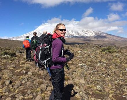
We cross the lunar desert of the saddle between Mawenzi and Kibo to reach Kibo Hut (15,400 ft) at the bottom of the crater wall. The remainder of the day is spent resting in preparation for an early morning final ascent. [5-6 hours walking] . Dinner and overnight at Kibo Hut.
DAY 6:
- Kibo Hut to Uhuru Point to Horombo Hut
- Elevation (ft): 15,430 ft to 19,341 ft to 12,205 ft
- Distance: 22 km
- Hiking Time: 10-13 hours
- Habitat: Arctic
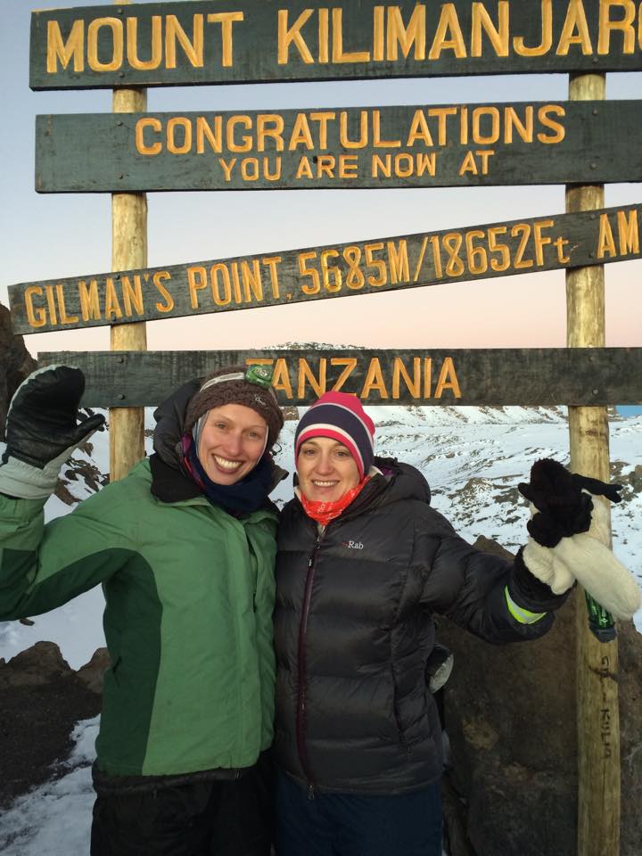
We start the final and most demanding part of the climb by torchlight around 1 a.m. We trek very slowly in the darkness on a switchback trail through loose volcanic scree to reach the crater rim at Gillman’s Point (18,600 ft). We rest here for a short time to enjoy the spectacular sunrise over Mawenzi. Those who are still feeling strong can make the three-hour round trip to Uhuru Peak (19,345 ft), passing close to the spectacular glaciers and ice cliffs that still occupy most of the summit area. The descent to Kibo Hut (15,400 ft) is surprisingly fast and, after some refreshments, we continue the descent to Horombo Hut for dinner and overnight (12,200 ft). [11-15 hours walking]
DAY 7:
- Horombo Hut to Marangu Gate
- Elevation (ft): 12,205 ft to 6,046 ft
- Distance: 20 km
- Hiking Time: 5-7 hours
- Habitat: Rain Forest
A steady descents takes us down through moorland to Mandara Huts (8,900 ft). We then continue descending through lovely lush forest on a good path to the Kilimanjaro National Park gate at Marangu (6,000 ft), where we are transferred back to hotel in Moshi. [5-6 hours walking]